Beginner’s guide · Move & explore
Choose a short route,
come home with margin.
Begin with a local waymarked walk, ordinary comfortable layers and a clear turnaround time. Navigation, weather and pace matter before specialist gear.
Quick answer
Walk a short familiar route with a written plan
Choose a maintained, waymarked local route with modest distance, little ascent and an easy way to shorten it. Check the current forecast, daylight, access notices and transport, then download or carry a map rather than relying on mobile signal. Wear already-comfortable footwear suitable for the surface, take water, food, layers and a charged phone, and tell someone the route and return time. Turn back at the planned time even if the destination is close; finishing with spare daylight and energy is successful hiking.
- 01
Route difficulty includes ascent, surface, navigation, exposure and remoteness—not mileage alone.
- 02
Use footwear that fits and has already been tested. A universal online shoe recommendation cannot account for foot shape, gait or terrain.
- 03
Carry a map or offline route and know how to locate yourself before signal disappears. A compass is useful only with practice.
- 04
Weather and daylight can change faster than pace. Set a turnaround time and preserve a margin for delays.
- 05
Leave no trace: stay on lawful routes, take litter home, control dogs and follow local fire, livestock and seasonal access guidance.
What to expect
The return journey uses the same legs
A viewpoint can make the outward pace feel like the whole achievement. Good route planning budgets energy, food, warmth and daylight for getting back when novelty and confidence have faded.
Distance
Five flat signed miles near home can be easier than two steep pathless miles. Compare terrain, ascent and escape routes.
Pace
A group travels at the pace of the slowest member and pauses count against daylight. Start earlier than the optimistic estimate.
Weather
Wind chill and wet clothing can change comfort quickly on exposed ground. Check mountain-specific forecasts where relevant.
Navigation
A blue dot is not a plan. Batteries fail and paths diverge, so identify junctions and catching features in advance.
Feet
Hot spots become blisters when ignored. Stop early, adjust socks and lacing and turn back if pain changes gait.
Emergency
No signal, a delayed rescue and an unclear location are normal planning possibilities in remote country. Leave exact information.
Core method
Plan the walk backwards from a safe return
Select a conservative route
Use a reputable local authority, National Trail, Ramblers or OS source. Read distance, ascent, surface, stiles, accessibility and transport details. Mark optional shortcuts and hard turnaround points. Avoid committing scrambles, tidal routes or exposed mountain ground as a first independent hike.
Prepare information and clothing
Check forecasts, alerts and daylight immediately before leaving. Download mapping, take a backup and write the route, parking or station, companions and expected return for a trusted contact. Dress in adjustable layers and pack waterproofs even when they are not worn at the start.
Navigate continuously
Orient the map at the start and confirm each major junction, landmark and direction while the answer is obvious. Keep phone power for navigation and emergencies rather than continuous media. Drink and eat before fatigue, notice surface changes and compare actual pace with the plan.
Turn around and close the plan
Use the pre-agreed time or any deterioration in weather, route, feet or group condition as a reason to shorten the walk without debate. On return, tell the trusted contact, dry equipment, record the real time and note the one change that would make the next route more comfortable.
Useful products
Products with a clear job in the setup
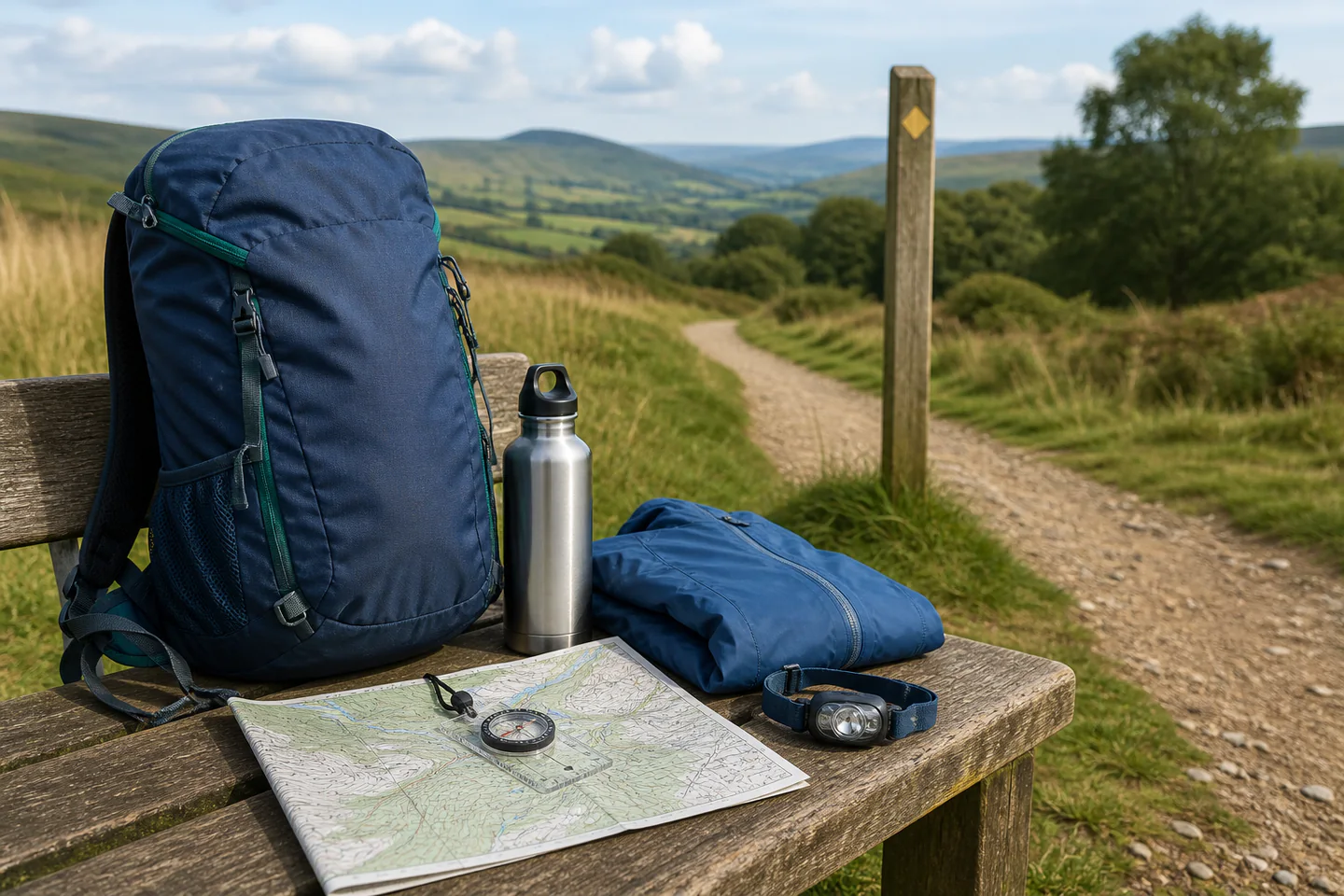
The Silva compass is a recognised baseplate design for learning map bearings, not a magic direction finder. Osprey’s Daylite carries a sensible day load if it fits the wearer, while the BORUIT head torch provides emergency light and a red mode. Footwear, waterproofs and packs should be tried for fit; these cards are starting points, not size-blind commands.
Silva Field Baseplate Compass
A clear baseplate and rotating bezel support established map-and-compass teaching.
Osprey Daylite 20-Litre Daypack
Twenty litres is usually enough for local day layers, food, water and navigation without inviting overpacking.
BORUIT Red and White LED Head Torch
Hands-free lighting transfers to camping, night photography and household emergencies.
First project
Complete one signed local loop with a turnaround rule
A deliberately easy route makes navigation, clothing and pacing visible while help and shortcuts remain close.
- 01
Read the whole route
Check ascent, surface, access, transport, daylight and a shorter option.
- 02
Share the plan
Give one person the map link, start point, companions and latest return.
- 03
Pack a small margin
Take water, food, waterproof layer, charged phone, map and basic first aid.
- 04
Confirm every junction
Orient the map and identify the next landmark before moving on.
- 05
Use the turnaround time
Shorten or reverse the route even when the goal feels near.
- 06
Close the loop
Message the contact, dry gear and record actual time and comfort.
What can wait
What can wait until the first result
Specialist kit is useful when a specific terrain or weather problem appears. It should not make a first route more ambitious.
- 01
Heavy walking boots bought online
Fit, flex and heel hold need trying; many easy routes suit comfortable existing footwear.
- 02
A GPS watch
Offline mapping and basic navigation solve the first route without another battery system.
- 03
Trekking poles
They can help balance or descents but need sizing and technique and are not compulsory on flat ground.
- 04
Remote mountain routes
Weather, navigation and emergency consequences rise faster than the mileage.
- 05
An ultralight kit overhaul
Removing weight without experience can remove the very margin needed for changing weather.
Upgrade path
Upgrade the repeated limitation
Spend after real walks identify a repeated issue in fit, weather protection, navigation or carry comfort.
Local loop
About £0–£60Existing layers, water and offline map
Learn pace, planning and turnaround.Regular day walks
About £60–£220Fitted footwear, waterproofs and daypack
Stay comfortable across varied surfaces.Hill routes
About £150–£500Map, compass, poles and warmer margin
Handle ascent, exposure and rougher ground.Remote hiking
About £350–£1,200+Specialist training and emergency systems
Manage navigation and delayed assistance.Safety & care
A summit is optional; the safe return is the plan
Turnaround decisions are not failure. Weather, pain, uncertainty and slower pace are valid evidence, and the conservative decision often preserves the next walk.
- Check current weather, daylight, access and transport and choose a route within the whole group’s ability and equipment.
- Carry navigation that works without signal, keep the phone charged and share a clear route and overdue action with a trusted person.
- Wear tested footwear and suitable layers, carry water, food and waterproof protection and respond early to cold, heat, pain or blisters.
- Stay away from cliff edges, fast water, livestock conflict, shooting activity and wildfire risk and follow all local signs and closures.
- For an emergency call 999 or 112 and ask for the appropriate service; in mountain areas ask for Police then Mountain Rescue and provide location clearly.
Outside help
When outside help earns its place
A signed local route needs no class. A navigation course becomes valuable before leaving marked paths, especially where contours, poor visibility and route choice must be interpreted rather than followed.
Choose graded walks and tell the leader about experience and access needs.
Ask about maps, compass loan, terrain, weather and maximum group size.
Representative UK learning options checked 18 August 2026; local prices, access, materials and tutor support vary.
Sources
Where the guidance came from
Ramblers and AdventureSmart anchor practical UK planning and emergency advice. Mapping authorities and experienced walking communities add route interpretation, kit fit and recurring beginner lessons.
-
01
Ramblers · Navigation
UK map, compass and route-finding guidance.
Open source -
02
Ramblers · Be prepared for emergencies
Planning, emergency information and safer walking context.
Open source -
03
AdventureSmart UK · Keep on track
Route, weather, skills and equipment decision framework.
Open source -
04
Ordnance Survey · GetOutside
UK mapping, navigation and outdoor skills guides.
Open source -
05
Reddit · r/UKhiking
Community evidence on routes, footwear, weather and beginner kit.
Open source -
06
Amazon UK · Field Baseplate Compass
Exact product catalogue page or ISBN used for the recommendation; current price, seller, specification and availability should be confirmed.
Open source -
07
Amazon UK · Daylite 20-Litre Daypack
Exact product catalogue page or ISBN used for the recommendation; current price, seller, specification and availability should be confirmed.
Open source -
08
Amazon UK · Red and White LED Head Torch
Exact product catalogue page or ISBN used for the recommendation; current price, seller, specification and availability should be confirmed.
Open source
Guide information and links checked 18 August 2026.